
Rose Cottage



Adults:
Children:
Overview
- free parking
- free wifi
Intro
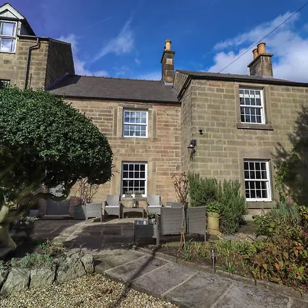
Situated 2.8 km from Peak District Lead Mining Museum, the 1-bedroom Rose Cottage Matlock invites guests to relax at a patio.
Rooms
The villa comes with a bathroom with a walk-in shower and a separate toilet. Bathrooms are also equipped with dryers for your comfort.
Location
Nine Ladies Stone Circle is a few minutes' drive from this 1-bathroom villa, while Matlock Bath cable car station is 800 metres away. Masson Mills is located around a 25-minute walk from the property, and Boat House bus station is around 10 minutes' walk away.
Eat
This Matlock property comprises a full kitchen with a microwave, a toaster, and glassware. Offering British dishes, restaurant High Tor Hotel Restaurant and Bar is located 10 minutes by car from the Matlock villa.
Facitilies
Rooms
- Sitting area
- Ironing facilities
Relax
- Garden area
- Cycling
- Golf course
- Fishing
Activities for Kids
- Cots
Reviews
Tourist VR
Categories
-
Facilities 10
-
Location 10
-
Total 10
-
Value for money 10
-
Cleanliness 10
-
Comfort 10
Location
- 1. St John The Baptist Church 1.41 km (4626 ft)
- 2. Pic Tor War Memorial 650 m (2133 ft)
- 3. Lumsdale Falls 1.41 km (4626 ft)
- 4. War Memorial 790 m (2592 ft)
- 5. Peak District Lead Mining Museum 2.01 km (1.25 mi.)
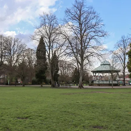
- 6. Hall Leys Park 830 m (2723 ft)
- 7. Life in a Lens Museum of Photography & Old Times 1.83 km (1.14 mi.)
- 8. Masson Mills 2.66 km (1.65 mi.)
- 9. St. Giles Church 470 m (1542 ft)
- 1. The Duke William 550 m (1804 ft)
- 2. Domino's Pizza 690 m (2264 ft)
- 3. Cantonese wok 1.18 km (3871 ft)
- 4. Maazi Matlock 740 m (2428 ft)
- 5. Cool River Cafe 740 m (2428 ft)
- 6. Butter Fingers 840 m (2756 ft)
- 1. Red Lion 260 m (853 ft)
- 2. Matlock Green/Lime Tree Road 340 m (1115 ft)
- 3. Lynholmes Road 550 m (1804 ft)
- 4. Causeway Lane 680 m (2231 ft)
- 5. Matlock Bath 1.84 km (1.14 mi.)
- 6. Heights of Abraham 2.62 km (1.63 mi.)
- 7. Heights of Abraham 2.98 km (1.85 mi.)
- 8. Matlock Interchange 1.03 km (3379 ft)
- 9. Bakewell Road 1.12 km (3675 ft)
Key Features
Check-In:
from 15:00 until 23:59
Check-Out:
until 10:00
Contact Information
Website
Visit hotel website